View my complete profile
posted by Unknown @ 2:43 PM
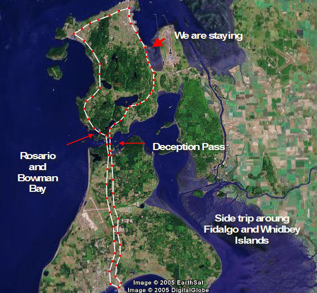
Nice map Tom. What software did you use to make this?The rest of the photos are great too. Sounds like you guys are having fun.
It is Google Earth for the map and the trail marker. I used SnagIt from Smith Micro for the overlay printing. It is a screen graber program and image editor.
Post a Comment
<< Home


2 Comments:
Nice map Tom. What software did you use to make this?
The rest of the photos are great too. Sounds like you guys are having fun.
It is Google Earth for the map and the trail marker. I used SnagIt from Smith Micro for the overlay printing. It is a screen graber program and image editor.
Post a Comment
<< Home